Chamoli Geological Overview

Chamoli Geological Overview
Chamoli Geological Overview
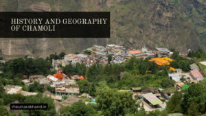
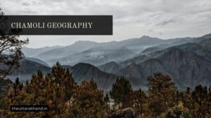
Chamoli Geological Overview : Chamoli district lies in the Central Himalayan region and constitutes a part of the famous ‘Kedar Kshetra’. Geologically, the district can be divided into two major divisions – the Northern division occupied by higher ranges and snow-covered peaks consisting entirely of medium to high grade metamorphic rocks, and the Southern division occupied by ranges of lower altitude, consisting of sedimentary and low grade metamorphic rocks.
The geological history and formation of the region is complex, spanning millions of years from the Mesozoic era to present day. The Himalayan mountains are relatively young, formed by the collision of the Indian and Eurasian tectonic plates. This collision caused intense compression and thrusting, resulting in complex folded and faulted rock strata across the region.
Main Geological Features
1. Complex Folding and Thrust Faulting
The main geological structures in Chamoli district are:
- Complex folds – tight overturned folds, recumbent folds, plunging folds etc. indicating intense compression
- Thrust faults – Major thrusts like the Main Central Thrust and Lesser Himalayan Thrust
- Overthrusts and nappes – large overthrust rock sheets driven over softer rocks
This complex deformation indicates the region is seismically active and unstable. Frequent earthquakes of varying magnitudes further attest to this instability.
2. Metamorphism
There has been intense metamorphism of the rocks in Chamoli, increasing in grade towards the higher Himalayan zones to the north. Rock types include:
- High grade gneisses, schists, marbles, quartzites
- Medium grade mica schists, phyllites, slates
- Low grade meta-sedimentary rocks
This indicates deep burial and uplift of the rock units under high heat and pressure conditions.
3. Recent Uplift and Incision
The higher ranges have undergone considerable uplift since the Mid-Pleistocene period. The deep gorges of the Alaknanda and Mandakini rivers indicate rapid recent incision, erosion and downcutting by the rivers, likely in response to this uplift.
Geological Formations and Changes Over Time
The rocks and structures seen in Chamoli today have evolved over millions of years through a long geological history:
1. Mesozoic (-251 to -66 million years)
The Himalayan zone was occupied by the Tethys Sea. Sediments eroded from the northern and southern landmasses accumulated on the sea floor.
2. Early Cenozoic (66 – 23 million years)
The Indian plate collided with Asia, closing the Tethys Sea. Compression and crustal thickening began. Early stage metamorphism and deformation commenced.
3. Miocene (23 – 5 million years)
Major thrust faulting initiated along the Main Central Thrust. Alaknanda Fault Zone activated. Intense compression and deformation resulted in large scale overthrusting.
4. Pliocene – Pleistocene (5 million – 11,700 years)
Continued compression led to higher grade metamorphism. Uplift accelerated in the Higher Himalayan zones. Valleys deepened as rivers cut downwards rapidly.
5. Holocene (11,700 years – present)
Ongoing uplift and incision, leading to the high peaks and deep valleys seen today. Continued instability indicated by active seismicity and erosion. Climate change effects also apparent.
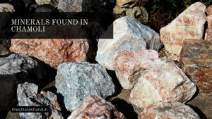
Types of Rocks
The main rock types found in the district include:
1. Metamorphic Rocks
- Gneisses – high grade, foliated
- Schists – medium grade, micaceous
- Marbles
- Quartzites
- Phyllites and slates – low grade
Formed by metamorphism of original sedimentary rocks like shales and limestones. Increasing metamorphic grade towards the north.
2. Sedimentary Rocks
Found in the Lesser Himalayan zones to the south. Include:
- Limestones
- Sandstones
- Shales
Originally laid down as sediments in the Tethys Sea. Later metamorphosed.
3. Intrusive Igneous Rocks
- Granites
- Volcanic rocks like basalts
Introduced in molten form into the crust. Volcanic rocks indicate past volcanic activity.
Conclusion to Chamoli Geological Overview
Chamoli Geological Overview, Chamoli district preserves evidence for:
- Sedimentation, metamorphism, intense deformation during Himalayan mountain building
- Recent uplift and incision of peaks, valleys by rivers
- Continuing instability and active seismicity
The landscape seen today records millions of years of geological processes driven by the India-Asia collision, erosion and climate change. This dynamic setting will ensure Chamoli’s geology continues evolving into the future.