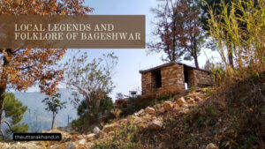
Geography and Environment of Bageshwar
Geography and Environment of Bageshwar
Geography and Environment of Bageshwar
Configuration of the Land and its Geographical Features
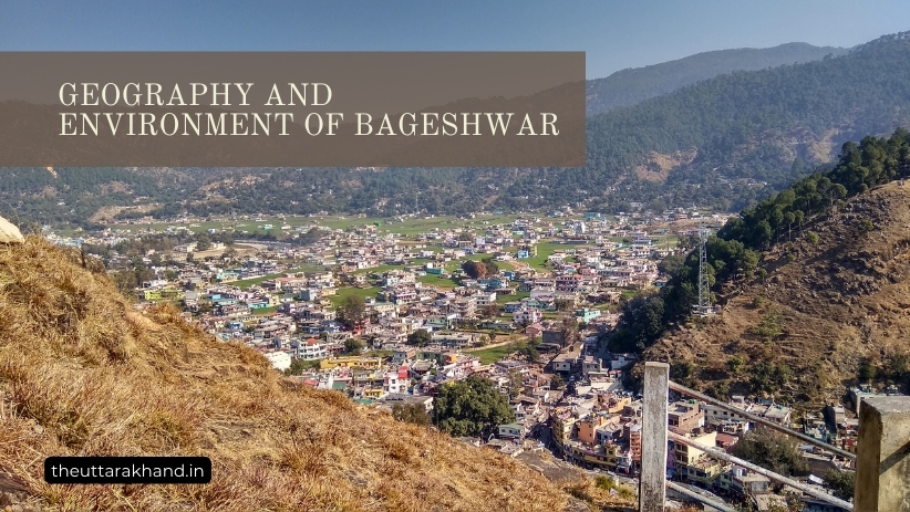
Introduction to Geography and Environment of Bageshwar
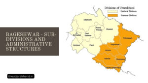
Geography and Environment of Bageshwar : Bageshwar district is located in the Kumaon division of Uttarakhand state in northern India. The district has a total geographical area of 2,246 sq km and is situated between 29°45′ N to 30°15′ N Latitude and 79°45′ E to 80°15′ E Longitude.
Bageshwar district is bounded by Chamoli district in the north, Almora district in the east, Pithoragarh district in south east, Champawat district in south and Nainital district in south west. The entire district lies in the hilly regions with elevations ranging from 800 to 6,000 meters above sea level.
Major Geographical Features
Some of the major geographical features of Bageshwar district are:
1. Mountains and Hill Ranges: The district has many high peaks, hill ranges and valleys. Some of the major mountains and ranges are:
- Pindar Range: Forms the northern boundary of the district. Major peaks are Tharkot (6,110 m) and Changuch (6,322 m).
- Milam-Martoli Range: Runs from north-west to south-east across the district. Peaks include Trishul (7,120 m), Nanda Ghunti (6,309 m) and Nanda Kot (6,861 m).
- Saryu Range: Forms the water divide between Saryu and Gori rivers in the western part of the district.
2. Valleys: The mountain ranges have created several long and narrow valleys such as Gori, Saryu, Ramganga etc. These valleys have terraced fields for cultivation.
3. Glaciers: There are several glaciers in the upper reaches of mountains, the largest being Pindari Glacier. Other glaciers are Sunderdhunga, Kafni, Namik and Panchchuli.
4. Rivers and Streams: The important rivers flowing through the district are Gori, Saryu, Ramganga and their numerous tributaries. Most rivers originate from glaciers.
Description of the Rivers and Water Bodies
The rivers and their tributaries form an intricate drainage pattern in Bageshwar district. The major rivers are:
1. Gori River: Rises near Milam glacier and valley. It flows in a south-westerly direction and joins the Kali river. Its important tributaries are Darma, Vyas and Sona.
2. Saryu River: Originates near Buda Kedar glacier and valley. Flows in a south-westerly course before entering the neighboring Champawat district. Jhulag, Panar and Ralam are its main tributaries.
3. Ramganga River: Rises from Namik glacier below Nanda Kot peak. Flows southwards via Munsiyari town and leaves the district. Its tributaries are Gungi, Sona and Deval.
4. Sarju River: Rises from the eastern slopes of Trishul and Nanda Ghunti. Joins Ramganga river as a tributary.
Some natural lakes such as Nauchini Tal, Sukha Tal, Pathar Nachauni Tal etc. are also found at high altitudes.
Description of Climate and Flora-Fauna
Climate
Bageshwar district has a sub-temperate climate with cold winters and mild summers. The climate varies across elevations and proximity to the Himalayas.
Winter (November to February): Cold and chilly with temperatures dropping below freezing point in higher reaches. Snowfall occurs at altitudes above 3,000 m. Foggy weather prevails in valleys.
Summer (March to Mid-June): Mild and pleasant with temperatures ranging 15-25°C. Occasional pre-monsoon showers occur.
Monsoon (Mid June-September): Moderate to heavy rainfall. Cloudy skies persist. Temperatures are cooler.
Autumn (October-November): Clear skies, warm days and cool nights. Ideal for travel and trekking.
Flora
Due to large variation in altitude and climate, Bageshwar district has diverse flora ranging from tropical deciduous to alpine trees and plants. Some major types are:
1. Tropical Deciduous Forests: Sal, Haldu, Bahera, Semal, Khair at lower elevations of valleys up to 1,000 m.
2. Sub-Tropical Pine Forests: Chir Pine, Deodar, Oak, Rhododendron between 1,000-2,000 m elevation.
3. Temperate Forests: Oak, Deodar, Fir, Spruce, Birch found at 2,000-3,000 m altitude.
4. Sub-Alpine Forests: Birch, Rhododendron and Juniper shrubs occur between 3,000-4,000 m elevation.
5. Alpine Zone: Hardy grasses, herbs and shrubs grow above treeline. Valley meadows have colorful wildflowers.
Many orchids, ferns, lichens and mosses are also found in the district. Several plants have high medicinal value.
Fauna
The fauna found in the district includes:
Mammals: Snow Leopard, Himalayan Black Bear, Musk Deer, Bharal, Serow, Goral, Barking Deer, Wild Boar, Jackal, Fox etc.
Birds: Monal Pheasant, Koklas Pheasant, Kalij Pheasant, Snow Partridge, Chukor Partridge, Woodpeckers, Parakeets, Barbets etc.
Reptiles: Cobras, Kraits, Vipers and Lizards are commonly found.
The Govind Pashu Vihar National Park and Sanctuary protects endangered wildlife in higher altitudes of the district.
Conclusion to Geography and Environment of Bageshwar
Geography and Environment of Bageshwar, Bageshwar district has a rugged mountainous terrain interspersed with deep valleys and rivers. The climate varies from sub-tropical at lower elevations to tundra type conditions at higher altitudes. The flora and fauna is abundantly rich and diverse across the landscape. The natural splendor and wilderness makes it an attractive destination for trekkers, nature lovers and wildlife enthusiasts.