Geography of Pithoragarh
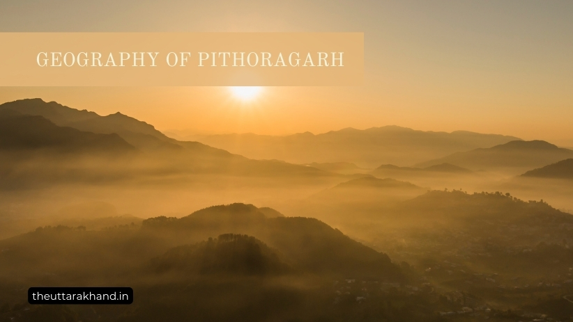
Geography of Pithoragarh
Geography of Pithoragarh
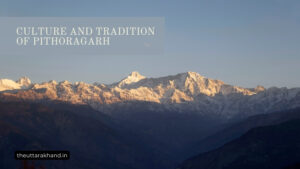
Geography of Pithoragarh : Pithoragarh district is located in the eastern Kumaon division of Uttarakhand state in India. The district lies between 29.4° to 30.3° North latitude and 80° to 81° East longitude along the eastern and southern part of the central Himalayas. Pithoragarh shares borders with several districts of Uttarakhand as well as the international border with Nepal. The geography of the district is diverse, encompassing high mountain peaks, alpine meadows, dense forests, rivers and valleys.
Location and Boundaries
Pithoragarh district is surrounded by the following districts and international border:
- North: Indo-Tibetan border
- East: Nepal (Kali river forms border)
- South: Almora district
- West: Bageshwar and Chamoli districts
The total area of the Pithoragarh district is 7217.7 sq km. It extends from the middle Himalayas in the south to the Great Himalayan range in the north.
Physiographic Divisions
Based on physiographic features, Pithoragarh district can be divided into three zones:
1. Himalayan Highlands
The northern parts of the district bordering Tibet consist of very high mountain peaks and glaciers of the Great Himalayan range. This region has an average elevation of 5000 to 6000 meters with several peaks over 7000 meters, including Panchchuli, Rajrambha and Chaudhara.
2. Middle Himalayan Valleys
The middle zone is characterized by high hills, valleys and rivers flowing through steep gorges. The elevation ranges from 1500 to 4000 meters. The hill slopes are covered with temperate forests dominated by pine, oak, rhododendron and other trees. The main valleys in this zone are Those, Gori, Darma, Byans and Kali river valley.
3. Sub-Himalayan Zone
The southernmost parts bordering the Terai consist of low Shivalik hills, valleys and alluvial fans called ‘bhabar’. The elevation ranges from 300 to 1500 meters. This region has sal and mixed deciduous forests. The main rivers are Gomati, Saryu, Ramganga and Kosi.
Prominent Geographical Features
1. Mountains and Peaks
Some of the notable mountains and peaks in Pithoragarh district are:
- Panchchuli (6904 m): Panchchuli is a group of five snow-capped Himalayan peaks. The Panchchuli glacier originates from these peaks.
- Rajrambha (6316 m): The third highest peak in the district located near the Nepal border.
- Chaudhara (6538 m): The second highest peak located in the Darma valley.
- Baudhansthali (2623 m): The highest peak in the lower Shivalik hills.
2. Glaciers
The major glaciers in Pithoragarh flowing down from the Great Himalayan range are:
- Panchchuli Glacier: One of the largest glaciers, it feeds the Gori river.
- Ralam Glacier: Feeds the Ralam river, a tributary of the Gori.
- Milam Glacier: Located close to the Indo-Tibetan border. Feeds the Gori river.
3. Alpine Meadows
Alpine meadows or ‘bugyals’ are found at high altitudes between 3500 to 4000 meters. Some well-known bugyals are:
- Chhiplakot Bugyal
- Vyas Valley Bugyal
- Ralam Bugyal
- Milam Bugyal
These meadows have lush green grass and colorful wildflowers during summer.
4. Rivers and Valleys
The important rivers flowing through the district are:
- Kali: Forms the Indo-Nepal border in the east. Jauljibi, Dharchula located on Kali river valley.
- Gori: Major tributaries are Darma, Sunderdhunga, Pungar and Ralam. Flows through the district in south-west direction.
- Dhauli: Forms the border with Bageshwar district in the west.
- Saryu: Rises near Bageshwar district border and flows southwards.
The main valleys carved out by these rivers are Darma, Byans, Those and Kali.
5. Forests
Due to large variation in altitude and climate, there is diversity in natural vegetation and forests:
Alpine Forests: Fir, birch, rhododendron forests found above 3500 meters
Temperate Forests: Oak, pine, deodar forests between 1500 to 3500 meters
Sub-tropical Forests: Sal, teak, mixed deciduous forests below 1500 meters
Climate
1. Temperature
- Summer (March – June): Max 18-25°C, Min 8-12°C
- Monsoon (July – Sep): Max 16-21°C, Min 10-14°C
- Winter (Nov – Feb): Max 7-13°C, Min -1 to 4°C
2. Rainfall
The average annual rainfall is about 1550 mm. More than 80% rainfall occurs during monsoon months of June to September. Winter rainfall from western disturbances occurs during December-February.
Conclusion to Geography of Pithoragarh
Geography of Pithoragarh : Pithoragarh district has extremely diverse geography from high Himalayan peaks to the plains bordering Nepal and Terai. The variations in topography, climate, rivers and vegetation across altitudes and physiographic zones provides rich biodiversity and natural beauty. The district offers tremendous scope for adventure tourism activities like mountaineering, trekking, skiing as well as pilgrimage tourism with many Hindu temples and shrines located in the region.