History of Pithoragarh
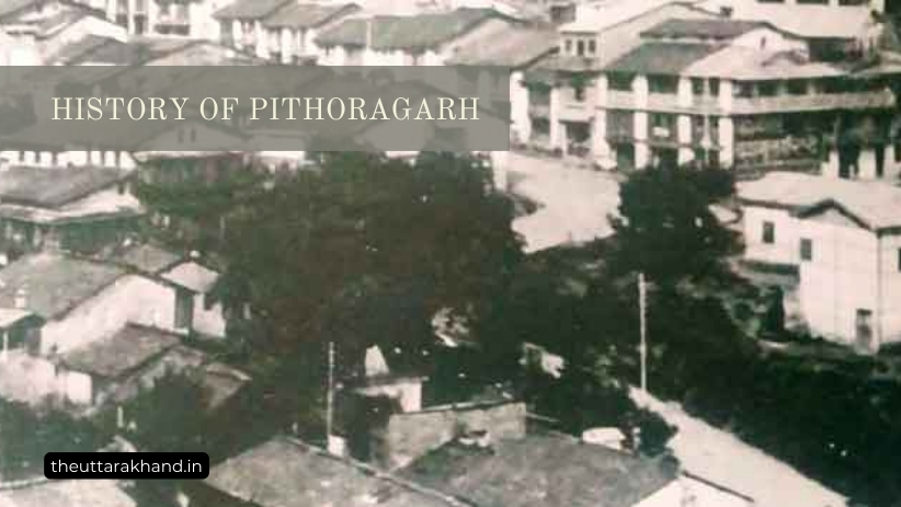
History of Pithoragarh
History of Pithoragarh
History of Pithoragarh : Pithoragarh district is located in the Kumaon division of Uttarakhand state in India. It was carved out of the Almora district in 1960 and is spread over an area of over 7000 sq km. The district lies in the eastern Himalayas and shares international borders with Nepal and China (Tibet).
Pithoragarh has a rich history and culture spanning several centuries. It has been inhabited since ancient times by various tribes and dynasties. The district has also played a strategically important role given its location along India’s northern borders.
Early History of Pithoragarh
The early history of Pithoragarh is not well documented. However, several local legends and folk tales give an indication of the region’s inhabitants in ancient times.
As per some accounts, the district was originally inhabited by the Kirata tribes who are mentioned in the Mahabharata. The Khasas, Tanganas, Kunindas and Pratanganas were some other tribes that found references in ancient Indian texts.
It is believed that great sages and seers visited the region in ancient times. According to the Mahabharata, the sage Jada Bharata performed penance in the area where the present-day Pithoragarh town is located.
The Kedar Khand scripture mentions the rivers Bhagirathi, Jahnavi, and Bheel Ganga flowing through the region. Several Hindu shrines dot the district, indicating this land was held sacred by Indians since ancient times.
Advent of the Garhwal Dynasty
For several centuries, Pithoragarh was part of the Garhwal Kingdom ruled by the Pal dynasty, which later came to be known as the Sah dynasty in the 15th century.
In 1803, the kingdom was attacked by the Gorkhas of Nepal. Amar Singh Thapa became the Governor of Garhwal under Nepalese rule which lasted until 1815.
Annexation by the British
In 1815, after war with the Gorkhas, the British annexed Garhwal kingdom as a part of British India. Garhwal was then divided into eastern and western parts. The western part was restored as the princely state of Tehri Garhwal under the Garhwal dynasty ruler Sudarshan Shah.
The eastern part, which included present-day Pithoragarh district, remained under direct British control as a part of the Kumaon division.
Creation of Pithoragarh District
On 24th February 1960, the Pithoragarh district was carved out of the Almora district. The remote border areas of Almora, along with the Pithoragarh tehsil, became part of the newly created Pithoragarh district.
In 1997, the Champawat tehsil of Pithoragarh was separated to create the Champawat district. Since then, the Pithoragarh district has comprised of the Pithoragarh and Didihat tehsils.
Strategic Importance
The Pithoragarh district has always been of strategic military importance for India. During the 1962 Indo-China war, the district witnessed fierce fighting between Indian and Chinese troops. The area continues to have a strong army presence guarding India’s borders.
The district was also affected during the 1999 Kargil War. Several soldiers from Pithoragarh sacrificed their lives fighting Pakistani forces in the mountains of Kargil. The Pithoragarh-based Naga Regiment played a pivotal role, with many soldiers winning gallantry awards for their heroic deeds.
Recent Developments
In recent years, Pithoragarh has developed considerably in terms of infrastructure, connectivity and economic opportunities while retaining its cultural essence and natural landscape.
With the rise of tourism, the district has emerged as an attractive tourist destination given its natural beauty, hills, rivers and temperate climate. Efforts are also on to boost air, rail and road connectivity which will further aid the region’s growth.
Geography
Pithoragarh district is situated in the eastern Kumaon Himalayas. It spans over 50 km from north to south, and 170 km from east to west, covering a total geographical area of over 7000 sq km.
Location
The district lies between 29°4′ to 30°3′ North Latitude and 80° to 81° East Longitude. It is bordered by Tibet and Nepal in the north and east respectively. Within Uttarakhand, it shares borders with the Bageshwar, Almora and Chamoli districts.
Terrain
The terrain primarily comprises high hills, valleys and rivers with elevations ranging from 1,000 m in the south to over 7,000 m in the Greater Himalayan range up north. The district has a rich variety of flora and fauna across its various climatic zones.
Rivers
The prominent rivers flowing through the district are Kali, Gori, Dhauli and Ramganga among others. Most rivers originate from the northern mountain ranges and are tributaries of either the Sharda or Kali river basins.
Climate
The climate of Pithoragarh varies from subtropical in the valleys to alpine conditions in the higher reaches. Summers are mild while winters can get quite cold with temperatures dropping below freezing point and snowfall at high altitudes.
Demography
As per the 2011 census, Pithoragarh district has a population of 4,85,993 comprising 2,44,746 males and 2,41,247 females. The district has a population density of 68 persons per sq km.
Pithoragarh town is the largest urban centre and district headquarters. Didihat, Gangolihat, Berinag and Dharchula are other key towns. Over 92% of the district’s population lives in rural areas.
The main languages spoken are Kumaoni and Hindi along with other local dialects. The majority religion is Hinduism followed by small Muslim, Sikh, Christian and Buddhist minorities.
The district has a literacy rate of nearly 82% as per 2011 census data. The male and female literacy rates stand at 90% and 74% respectively.
Economy
Agriculture is the backbone of Pithoragarh’s economy engaging over 75% of the working population either directly or indirectly. Other economic activities revolve around forestry, horticulture, animal husbandry and tourism.
Agriculture
The main crops grown in the district are rice, wheat, mandua, jhangora and potato among others. Cash crops like ginger, turmeric and rajma are also cultivated. However, the availability of arable land is limited due to the mountainous terrain.
Horticulture
Horticulture is an emerging sector with the cultivation of off-season vegetables and fruits like apple, peach, plum, apricot etc. Medicinal plants are also grown over large tracts of land.
Animal Husbandry
Animal rearing is an integral part of the rural economy. Sheep, goats and buffalo are reared for wool, meat and milk. High altitude villages are also home to yaks which provide milk, meat and transportation.
Forestry
Pithoragarh has rich natural forests spanning over 60% of its total area. Pine, deodar, oak and rhododendron are the main trees found in the forests along with many medicinal herbs. Forest-based produce like timber, fuelwood and herbs provide supplementary income.
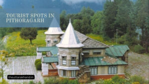
Tourism
In recent times, tourism has emerged as an important sector given the district’s natural beauty and cultural heritage. Places like Patal Bhuvaneshwar, Gangolihat, Munsiyari and the Panchachuli base are top tourist spots.
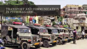
Transport and Connectivity
Air
The Naini Saini Airport at Pithoragarh operated by the Indian Air Force provides limited civilian flights. The airstrip was built in 1991 and can handle 18-seater Dornier aircraft.
Rail
The nearest railway stations are at Tanakpur (150 km) and Kathgodam (190 km) which connect Pithoragarh to Delhi and other major cities. Work on extending the broad-gauge railway line to Pithoragarh is currently underway.
Road
Pithoragarh is connected by road to Haldwani, Almora, Bageshwar, Champawat and Dharchula. Regular bus services operate along these routes. Taxis are available for local transportation. The condition of roads at high altitude areas is however relatively poor.
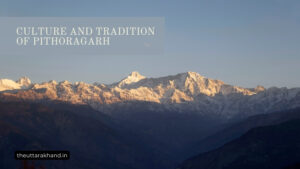
Tourism and Culture
Pithoragarh offers a unique confluence of natural beauty and cultural heritage making it an attractive tourist destination. Key attractions include:
- Ancient temples like Mostamanu, Kamaksha, Ulkadevi
- Scenic spots like Soar Valley, Chaukori, Berinag
- Wildlife sanctuaries like Askot
- Treks to Pindari Glacier, Milam Glacier, Ralam Glacier
- Patal Bhuvaneshwar caves
- Panchachuli base camp
- Shakti Peethas like Jauljibi, Gangolihat
The local culture is influenced by folk music and dances like Chhopati, Jagar, Chanchari and Jhumeila. Famous fairs and festivals celebrated in the district include Nanda Devi Raj Jat Yatra, Ganga Dusshera of Jauljibi and the autumn trade fair at Jauljibi.
The district is also renowned for its unique wood carving artworks. The traditional food mainly comprises rice, dal, vegetables and meat dishes in the higher villages.
Administration
Pithoragarh district has 3 subdivisions – Pithoragarh, Gangolihat and Dharchula. There are 6 development blocks – Berinag, Didihat, Gangolihat, Kanalichhina, Munsiyari and Pithoragarh.
The district administration is headed by the District Magistrate who is supported by various government officials handling affairs related to revenue, law and order, development etc.
At the grassroots level, elected bodies like the Zilla Panchayat, Block Samitis and Gram Panchayats ensure decentralized governance. The Indian Armed forces also manage certain border areas given the strategic location.
Challenges
Despite its vast tourism potential, Pithoragarh faces several challenges in its path to development:
- Inadequate infrastructure and connectivity
- Lack of industrialization
- Over-dependence on agriculture
- Manpower shortage
- Migration of youth to plains for jobs
- Poor health and education facilities in remote areas
Concerted efforts by the government and local authorities are needed to harness the district’s full potential for economic and human development.
Conclusion to History of Pithoragarh
History of Pithoragarh : Pithoragarh has a distinct identity carved out by its unique geography, history and culture. From being inhabited by ancient tribes to the advent of Hindu pilgrims and dynasties, Pithoragarh has always been a strategically important region located at the edge of the Indian subcontinent.
Today, as it marches ahead on the path of progress, the need is to strike the right balance between economic growth and preserving its ecological and cultural fabric. If adequate thrust is provided to sectors like tourism, horticulture and food processing, Pithoragarh can develop into one of the leading districts of Uttarakhand.