Rivers and Tributaries of Tehri Garhwal, Uttarakhand

Flora and fauna
Rivers and Tributaries of Tehri
Rivers and Tributaries of Tehri : Tehri Garhwal district is located in the Garhwal region of Uttarakhand state in India. The district is named after its headquarters town, Tehri. It spans over an area of 3,642 sq km and had a population of 616,409 as per the 2011 census.
The district is situated at the convergence point of two important Indian Himalayan rivers – the Bhagirathi and the Bhilangna. Several major tributaries drain into these two rivers within Tehri Garhwal, making it an area of exceptional hydrological importance.
The Bhagirathi River
Overview of Rivers and Tributaries of Tehri
Rivers and Tributaries of Tehri : The headwaters of the revered Ganga river are formed by the joining of the Bhagirathi and Alaknanda rivers at Devprayag further downstream. The Bhagirathi originates at the snout of the Gangotri glacier, one of the largest glaciers in the Himalayas. For over 200 km, it flows in a southwesterly direction along the strike of the ranges, fed by its tributaries, before meeting the Alaknanda at Devprayag. The entire course of the Bhagirathi lies within Tehri Garhwal district.
The Bhagirathi basin covers an area of around 1,550 sq km within the district. The river enters at the northern corner of Tehri Garhwal from Uttarkashi district. For 85 km, it separates Tehri Garhwal from Chamoli district in the east. Thereafter, it flows for 50 km along the boundary between Tehri Garhwal and Rudraprayag districts, before entering exclusively into Tehri Garhwal near Dharasu bend.
Major Tributaries
The major tributaries of the Bhagirathi within Tehri Garhwal district are:
Jadh Ganga
The Jadh Ganga meets the Bhagirathi at Bhaironghati, about 40 km downstream from the snout of the Gangotri glacier. Rising from the eastern slopes below Kedarnath peak in Rudraprayag district, the Jadh Ganga is fed by its tributaries – the Saindhar and the Sural rivers.
Bhilangna River
The Bhilangna is the largest tributary of the Bhagirathi in terms of discharge and catchment area. It originates from the eastern slopes of Bandarpunch massif and is fed by the Rishiganga as its major tributary. The confluence point with the Bhagirathi is near Ghanshali.
Asiganga River
The Asiganga meets the Bhagirathi near New Tehri town. It originates from the northern slopes of the Pachu peak and is fed by the Balganga river.
Other Tributaries
Some other notable tributaries of the Bhagirathi within Tehri Garhwal district include Songanga (joins near Narendranagar), Ganga (near Srinagar), and Bhagirathigad (near Dharasu bend).
The Bhilangna River Basin
The Bhilangna river originates from the eastern slopes of Bandarpunch massif in Tehri Garhwal district at an elevation of around 3,500 m. For most part of its 100 km long course, the river flows through a narrow gorge separated by ridges.
The Bhilangna meets Bhagirathi river near Ghanshali in the northwest corner of Tehri Garhwal district. Within the district, it is fed by its major right bank tributary, Rishiganga before joining the Bhagirathi.
The Bhilangna river basin covers an area of 1,550 sq km within Tehri Garhwal district. The basin elevation ranges from 1,400 m to 6,500 m.
The Song River Basin
The Song river is an important tributary in the Tehri Dam reservoir catchment area. It originates from the northern slopes of Khatling peak and flows in a southwesterly direction for 65 km before meeting Bhagirathi river near Narendranagar. The Song river basin has a catchment area of about 900 sq km within Tehri Garhwal district.
The Asi Ganga River Basin
The Asi Ganga originates from the northern slopes of Pachu peak in Tehri Garhwal district. The Balganga river which rises from the eastern slopes of Bandarpunch range is its major tributary. The Asi Ganga meets Bhagirathi river near New Tehri town after flowing for about 60 km. The basin covers an area of 700 sq km within Tehri Garhwal district.
Importance of Rivers
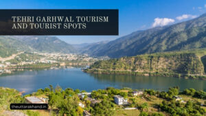
Rivers and Tributaries of Tehri : The rivers of Tehri Garhwal Himalayas are lifeline for local inhabitation and biodiversity in the region. Besides providing important ecosystem services, the rivers hold socio-cultural and religious significance. The glacial meltwater rivers support irrigation, hydropower generation and tourism activities.
However, developmental activities in the fragile Himalayan region have impacted the rivers by way of habitat loss and flow regulation. With climate change effects exacerbating, maintaining ecological integrity of the rivers is vital for sustainability of the region. Careful planning and impact assessment is necessary for any developmental projects over the rivers.
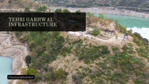
Tehri Dam Project
The Tehri dam is the highest dam in India and one of the highest in the world. It is constructed over the confluence of Bhagirathi and Bhilangna rivers near New Tehri town. The dam creates a large reservoir spread over 52 sq km area with storage capacity of 2,610 million cubic metres.
The Tehri hydroelectric complex is designed to generate 2,400 MW hydropower. It hugely augmented the irrigation potential in Uttarakhand and addressed the power shortage issue. However, the project also led to large scale deforestation, loss of biodiversity and soil erosion. Proper environmental safeguards and catchment area treatment measures are essential for sustainability of the project.
Conclusion to Rivers and Tributaries of Tehri
Rivers and Tributaries of Tehri, the rivers and tributaries of Tehri Garhwal form unique geographic features of the district. The glacial fed rivers are integral to regional sustainability in terms of water security, food security, clean energy and disaster mitigation. Maintaining aviral dhara (continuous flow) of the rivers should be the priority while planning developmental projects over them. Comprehensive environmental and social impact assessments along with public consultations can help achieve a optimal trade-off between conservation and development.