Rivers of Pithoragarh
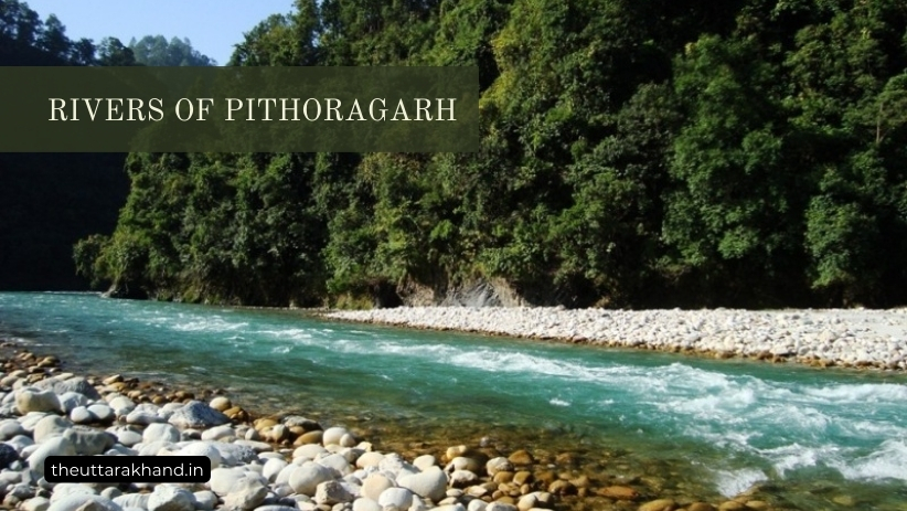
Rivers of Pithoragarh
Rivers of Pithoragarh
Rivers of Pithoragarh : Pithoragarh district in the state of Uttarakhand is blessed with numerous rivers and streams that are the lifeline of the local communities. Many of these rivers originate from glaciers and snow-fed streams in the higher Himalayas within Pithoragarh district, while some enter from neighboring districts.
The major river systems in Pithoragarh are:
- Kali River System: The Kali river forms the continuous eastern border of the district with Nepal. It is the most prominent river, with immense potential for irrigation and hydropower generation.
- Gori River System: The Gori river is a tributary of the Kali river, joining it at Jauljibi. It originates from glaciers near Milam.
- Dhauli River System: Formed by two headwaters – Dharamganga and Lassar streams. It is also a tributary of the mighty Kali.
- Sarju River System: Forming parts of the southwestern boundary of Pithoragarh district. A major tributary of the Kali.
In this article, we will explore the origins, tributaries, local significance and key facts about these major rivers systems of Pithoragarh.
Kali River System
Origin and Course
The Kali river originates from the Lipu Lekh pass (5,122m) in the trans-Himalayan region near the border with Tibet/China. It then flows in a serpentine course along the eastern border of Pithoragarh district with Nepal for around 400 kms before entering the plains near Tanakpur, where the name changes to Sharda.
Tributaries
The major tributaries of Kali river within Pithoragarh district are:
- Gori River: Joins Kali at Jauljibi
- Dhauli River: Joins Kali near Tawaghat
- Kuti Yangti River
- Sarju River: Joins Kali near Pancheshwar
- Girthi River: Has a short stretch in NW Pithoragarh before entering Nepal
- Ramganga River: Forms part of Pithoragarh’s border with Almora district
Significance and Local Importance
The Kali river basin covers a vast area of the district – nearly the entire northern and eastern parts. The river is like a lifeline for local communities with immense spiritual, economic and ecological significance:
- Water for irrigation and drinking: Kali river supplies water for irrigation to fields along its banks which allows growing crops. The water is also used for drinking after treatment.
- Hydropower Potential: As a perennial snow-fed river descending from high altitude, Kali river system has immense potential for hydroelectric power generation. The Pancheshwar dam project is coming up across the Kali river which will be amongst the largest in India.
- Ecological Significance: The forests along the Kali river banks are home to wildlife like leopards, Himalayan black bears, musk deer and over 300 species of birds. Protecting these forests ensures water security in the Ganga river basin.
- Cultural and Spiritual Importance: The Kali (Sharda) river basin has been inhabited since ancient times. The Kalika temple near Dharchula attracts thousands of devotees every year who come to worship the river goddess. Many Hindus also perform last rites along the Kali river.
Clearly, the Kali river system is the most prominent and important river network in Pithoragarh district – sustaining local communities and ecology in multiple ways.
Gori River System
Origin and Course
The Gori river originates from two sources – the eastern branch starts from a glacier near Untadhura ridge while the western branch is fed by glacier meltwaters near Milam village. The two branches converge and the Gori river ultimately joins the Kali at Jauljibi in the lower regions of Pithoragarh.
Tributaries
The main tributaries of the Gori river within the district are:
- Ralam river: Joins Gori at Ralam valley
- Gungri river: Glacier-fed stream joining Gori near Darma
- Gumpa river: Originates from Rowaling glacier
Local Significance
While relatively smaller than Kali, the Gori river basin is a lifeline for around 50 villages in the northern mountainous parts of Pithoragarh – including the historically famous Milam village and Ralam valley.
- The Gori provides critical irrigation water for growing potato, rajma beans and other crops in the short growing season. Apple orchards also thrive due to year-round water availability.
- Hydropower potential from the perennial snow-fed Gori river is immense but largely untapped. Mini and micro hydel projects can provide clean electricity to the remote mountain villages.
- The Gori river valley also offers breathtaking views of the Panchachuli, Rajrambha and other Himalayan peaks, attracting tourists for trekking and mountaineering expeditions. This provides livelihood opportunities for locals.
In essence, the Gori river sustains the fragile mountain ecology and scattered villages in parts of northern Pithoragarh with its perennial water flow. Protecting forests in its catchment area is critical for long term sustainability.
Dhauli River System
Origin and Course
The Dhauli river is formed by two headwaters – the Dharamganga stream originating from a glacier near the Darma pass and Lassar stream from a nearby glacier. The combined river then flows in a serpentine southeast direction before joining the Kali river at Tawaghat.
Local Significance
While not very long, the Dhauli river basin drains a large fertile area of the eastern district. Several tributaries and streams joining Dhauli provide irrigation water to fields near villages like Madkot, Kuti, and Tawaghat.
In fact, Dhauli river supports agriculture, horticulture and livestock rearing which are the primary occupation in the district.
Sarju River System
Origin and Course
The Sarju river originates from the eastern slopes of the Almora district and then forms parts of the southwestern boundary between Almora and Pithoragarh districts for nearly 65 kms. It is an important tributary of the Kali river, ultimately joining it near Pancheshwar.
Local Significance
The Sarju flows through dense forests in the lower hills before entering Pithoragarh plains near Kapkot. Several small streams and tributaries joining it provide reliable irrigation water for growing rice, lentils, vegetables and cash crops.
In fact, the entire Kapkot region lies in the Sarju river basin and it empowers the agriculture economy supporting dozens of villages.
The Sarju river is also culturally significant as ancient texts state that it originates from the feet of Lord Vishnu. Several temple complexes have existed on the Sarju banks since centuries.
Other Rivers and Tributaries
Some other smaller rivers and tributaries originating within or entering Pithoragarh districts are:
- River Girthi: Has a short stretch in NW Pithoragarh before flowing into Uttarakhand
- Ramganga River: Forms part of NW border with Almora district
- Keogad River: Enters from Tibet, has small stretch before entering Nepal
- Kutiyangti River: Rises from a glacier near the Lumpiyadhura pass and joins Kali downstream
- Pindar River: Rises in the Pindari glacier and joins Alaknanda river in Chamoli district
- Gomati River: Flows through the eastern valleys, has immense hydropower potential
These smaller rivers and their numerous tributaries drain the valleys and bring much needed water for irrigation and groundwater recharge in various parts of Pithoragarh district. Protecting their fragile catchment areas is necessary for sustainability of local communities.
Significance of Rivers in Pithoragarh
As evident from the detailed exploration above, rivers are the backbone supporting ecology and economy in the predominantly mountainous terrain of Pithoragarh district. They shape the culture and daily activities of local communities in profound ways:
Water Security: Perennial rivers like Kali ensure year-round water availability while smaller streams provide irrigation water to fields near villages in valleys and slopes. This enables growing crops and horticulture.
Hydropower Potential: As they descend from great heights, the snow-fed rivers of Pithoragarh have immense capability for electricity generation through hydroelectric projects, both big and small.
Tourism Opportunities: The serpentine rivers flowing through dramatic landscapes, surrounded by majestic Himalayan peaks offer visual splendor. This draws tourists for trekking, fishing and cultural immersion.
Wildlife Support: The forests along river banks support varied wildlife found in Pithoragarh like leopards, black bears, deer and rare birds. Protecting these riparian forests ensures healthy river flows.
Cultural Significance: Settlements have flourished on the banks of Kali, Gori, Sarju and other rivers since ancient times as depicted in scriptures. Rivers are worshipped as goddesses. The culture has evolved around rivers over millennia.
Clearly, the rivers of Pithoragarh provide sustenance, livelihoods and inspiration to local communities while also supporting incredible biodiversity. As lifelines, these rivers must be protected and rejuvenated through forest conservation and spring revival programs for a sustainable future.
Conclusion to Rivers of Pithoragarh
Rivers of Pithoragarh : Pithoragarh district is blessed to have four major river systems – Kali, Gori, Dhauli and Sarju along with numerous tributaries and streams draining the valleys and slopes. These rivers originating from glacial meltwaters and underground aquifers provide perennial irrigation water to fields, drive hydropower projects and attract tourists while also supporting incredible biodiversity in forests along their banks.
For lakhs of people in hundreds of villages, these rivers mean life and livelihoods. The culture and ecology have evolved around river systems over centuries. Protecting the fragile Himalayan catchment areas and rejuvenating dying springs is the only way forward to ensure water security for future generations. This is the responsibility of both government agencies as well as local communities.
With proactive action focused on conservation based on community participation, the rivers of Pithoragarh which have given so much can be revived to support increasing population and aspirations in a sustainable manner.