Wetlands of Uttarakhand

Wetlands of Uttarakhand
Wetlands of Uttarakhand
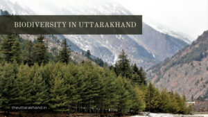
Wetlands of Uttarakhand : Wetlands are areas where water covers the soil, or is present either at or nearthe surface of the soil all year or for varying periods of time during theyear, including during the growing season. Water saturation largelydetermines how the soil develops and the types of plant and animalcommunities living in and on the soil. Wetlands may support both aquaticand terrestrial species.
The prolonged presence of water creates conditionsthat favor the growth of specially adapted plants (hydrophytes) and promotethe development of characteristic wetland (hydric) soils. While wetlands anddeepwaters cover only about 6% of the earth’s surface, they provide habitatsfor as much as 20% of the planet’s life-forms.
Wetlands of Uttarakhand arecategorized as Inland or non-tidal wetlands. These wetlands are threatened byincreasing developmental activities, negetive impacts of tourism, tremendousgrazing pressure and degradation of their catchment areas.
Here we havegiven a brief description of wetlands of Uttarakhand.
Major Wetlands of Uttarakhand
BEDNI KUND
- This tarn is set in the famous Bedni bugyal (alpinemeadow) and is the site of the fi rst stage for the famous Nanda Devi Raj Jatyatra.
- A large number of buffaloes and scrub cattle, as well as, sheep andgoats are grazed here during the monsoon.
- Yar-tsa-gombu (Cordycepssinensis) collection is a recent and growing phenomenon here.
ROOP KUND
- Roop Kund is presently the second stage of the Raj Jatyatra, and hence, thousands of pilgrims visit this lake. It is also a well knowndestination for trekkers, and Yar-tsagombu collectors pass this area en routeto the next valley, over the Jiura Galli Pass.
- One of the unique and interestingmystry about Roop Kund is existence of hundreds of year oldhuman remainsin it.
- A recent genetic study has established that out of 38 remains understudy 24 belong to Indians and rest are of Youropean orgin mainly that ofmeditarranean origin.
HUM KUND
- This lake is the third stage of the Raj Jat yatra, before thepilgrims descend to Suttol village.
- This lake is a well known, though lessfrequented (because of diffi culty) trekkers’ destination.
- Religious rites areperformed at the small shrine and this is also the site of some Yartsa-gombucollection.
BHEKKAL TAL
- This is also the site where many arrow-heads are to befound embedded in trees, and are fabled to have rained down here along withbolts of lightning; perhaps relics of an ancient armed confrontation.
- Thisentire area is used very extensively during the monsoon to graze buffaloes,and the effects of persistent and intense grazing by this very large ungulatehas very visible impacts on the vegetation here.
- A very large number of sheepand goats also pass by here en route to the adjoining alpine meadows addingto the intensity of grazing.
- Perhaps because of the wallowing by buffaloes,this lake is clearly very eutrophic.
BRAHMA TAL
WETLAND TYPE: Tarn
ALTITUDE: 3,235 m asl
SIZECLASS: Small
SUB-WATERSHED BASIN: Nandakini
DEPTH CLASS: Deep
TROPHIC LEVEL: Eutrophic
VEGETATION TYPE: Moist alpine
- There is a small shrine here dedicated to Lord Brahma where religious ritesare performed.
- Along with the religious rites performed at Brahma Tal, thisarea also holds many buffalo camps during the monsoon, while grazing ofsheep and goats is quite intense too.
- Some Yar-tsa-gombu collection is alsoreported from these alpine meadows in spring, just after the snow-melt.
HEMKUND
WETLAND TYPE: Tarn
ALTITUDE: 4,204 m asl
SIZECLASS: Medium
SUB-WATERSHED BASIN: Bhiundar gadhAlaknanda
DEPTH CLASS: Medium
TROPHIC LEVEL: Oligotrophic
VEGETATIONTYPE: Moist alpine
- Hem Kund Sahib is a medium-sized tarn that has afamous and heavily frequented Sikh gurudwara.
- Despite the large number ofpilgrims that take a holy dip, it remains oligotrophic because of strict rulesfor maintaining its cleanliness
SATOPANTH TAL
- Formed at the intersection of the moraines of atributary glacier meeting the Satopanth Glacier at right angles. It is situated ina Reserve Forest area.
- It is medium-sized and seems to have dramatically lostdepth quite recently.
- Such radical changes in glacial and proglacial lakes arecommon due to shifting
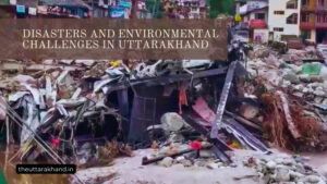
Threats and Challenges to Wetlands
The wetlands of Uttarakhand face several threats and challenges:
- Developmental activities: Road construction, hydropower projects, tourism infrastructure etc. are threatening wetlands through direct loss and fragmentation of habitat.
- Tourism: Unregulated tourism is causing pollution and degradation of catchments of wetlands.
- Grazing: Tremendous grazing pressure by livestock especially during monsoon is impacting wetland vegetation and water quality.
- Catchment degradation: Deforestation and land use changes in catchment areas is reducing water flow and increasing siltation in wetlands.
- Climate change: Changes in temperature and precipitation patterns may alter water availability in wetlands. Glacial retreat due to warming is also impacting some high altitude wetlands.
- Invasive species: Spread of invasive plant species like Lantana is reducing native vegetation cover around wetlands.
- Lack of research: There have been few detailed research studies on wetlands of Uttarakhand to develop conservation strategies based on scientific evidence.
Conservation and Management
Some steps that can be taken for better conservation and management of Uttarakhand’s wetlands include:
- Detailed ecosystem assessments and formulation of management plans for prioritized wetlands
- Regulate developmental activities in and around ecologically sensitive wetlands
- Promote community participation in wetland conservation through incentives and awareness
- Control spread of invasive species
- Implement grazing protocols such as rotational grazing to reduce pressure
- Reforestation programs in degraded catchments to improve hydrology
- Promote ecotourism with strict regulations on numbers and activities
- Detailed research studies on biodiversity, ecosystem services, threats etc. to guide conservation efforts
- Declaration of sensitive wetlands as conservation reserves/national parks
- Strict pollution control in catchments and around wetlands
Conclusion to Wetlands of Uttarakhand
The wetlands of Uttarakhand provide valuable ecosystem services and support unique biodiversity. However, they face serious threats from unsustainable development, tourism, climate change etc. There is an urgent need for detailed research and ecosystem-specific conservation plans to protect these critical ecosystems. A landscape approach involving local communities and managing catchments is crucial for the long term preservation of Uttarakhand’s wetlands.
What are the major wetlands of Uttarakhand?
Some major wetlands of Uttarakhand are Bedni Kund, Roop Kund, Hemkund, Bharadhsar, Kanasar, Basuki Tal etc. Many are high altitude alpine wetlands.
What services do these wetlands provide?
Wetlands provide provisioning services like fodder, water; regulating services like groundwater recharge, flood control; cultural services like tourism, recreation etc.
What are the threats to Uttarakhand’s wetlands?
Major threats are from developmental activities, unregulated tourism, tremendous grazing pressure and catchment degradation. Climate change is also an emerging threat.
How can these wetlands be conserved?
Steps like ecosystem assessments, community participation, grazing controls, catchment treatment, declaration as protected areas etc. can help in their conservation.
What is the need for conserving Uttarakhand’s wetlands?
These wetlands support unique biodiversity, provide ecosystem services to local communities and help maintain water security. Their conservation is vital.