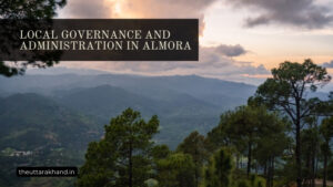
Geography and Climate of Almora
Geography and Climate of Almora
Geography and Climate of Almora
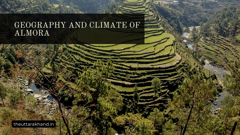
Geography and Climate of Almora : Almora is a picturesque district nestled in the Kumaon region of Uttarakhand. Surrounded by breathtaking Himalayan peaks, Almora offers stunning natural vistas and grandeur that draws tourists from around the world. The unique geography and climate of Almora contributes to its allure as a popular hill station destination.
Location and Boundaries
Almora district lies between 29.4° to 30.3° North latitude and 79.3° to 80.1° East longitude in the eastern Kumaon division of Uttarakhand state. It covers an area of about 3390 sq km.
The district is bounded on the north by Tibet, on the east by Pithoragarh district, on the south by Nainital district, and on the west by Garhwal region.
Physiographic Divisions
Based on physiographic features, Almora district can be divided into the following zones:
1. Greater Himalayan Zone
This zone lies to the extreme north beyond the high peaks forming the northern rim of the district. It has rugged mountains, glaciers, deep valleys and snowfields.
Major Peaks: Panwali Dwar (6663m), Nanda Ghunti (6309m)
Glaciers: Pindari, Sunderdhunga, Kafni, etc.
2. Lesser Himalayan Zone
This zone comprises of the middle slopes of mountains with heights ranging from 1200 to 3000 metres above mean sea level. It has various hill ranges like Nag Tibba, Banj, Meola, etc.
Major Rivers: Gagas, Sarju, Kosi
Hill Ranges: Nag Tibba, Banj, Meola
3. Bhabar Zone
This zone lies along the southern margins of the lesser Himalayas. It has wide valleys and ridges covered with gravel and boulders brought by streams coming down from mountains.
Major Rivers: Gagas, Sarju, Kosi, etc.
Drainage System
The following major rivers and their tributaries drain Almora district:
- Kosi River: Originates near Kausani and is fed by Dhauli Ganga west of Almora town. It drains central parts of the district.
- Sarju River: Rises from the southern slopes of Nanda Devi East peak. It drains eastern parts of Almora district.
- Gagas River: Originates from the Pindari Glacier and drains the northwestern areas.
- Ramganga River: Originates from the Namik Glacier below Nanda Kot peak. It drains the southwest areas.
- Saryu River: Rises from Milam Glacier and drains the high altitude northern areas.
These rivers ultimately join the mighty Ganges.
Climate
Factors Influencing Climate
The climate of Almora district is influenced by the following geographical factors:
- Altitude: Varies from 800 to 8000 metres above sea level leading to large climatic variations.
- Latitude: Lies in the warm temperate zone.
- Distance from Sea: Approximately 350 kms away from the sea.
- Himalayan Ranges: Prevents cold winds from central Asia. Also causes orographic rainfall.
- Valley Orientation: North-South orientation allows monsoon rainfall.
Seasons
The climate of Almora can be divided into the following seasons:
1. Cold Weather Season (December – February)
In these winter months, the weather is cold and chilly. Temperatures can drop below freezing point in high altitude areas with snowfall. Foggy conditions prevail in the valleys. The average temperature remains 10°C to 15°C.
2. Summer Season (March – Mid June)
The summer months are marked by bright sunny days and occasional thunderstorms. The temperatures range between 25°C to 30°C on average.
3. Rainy Season (Mid June – September)
The southwest monsoon brings heavy rainfall to Almora district during these months. The area receives about 70-80% of its annual rains in this season. The average rainfall is 1500mm.
4. Post Monsoon Season (October – November)
This transitional period has clear skies and a drop in temperatures. The retreating monsoon causes rainfall some days. The average temperature is around 20°C.
Agro-Climatic Zones
Based on variations in elevation, temperature, rainfall and soil types – the following agro-climatic zones can be identified in Almora district:
Zone 1 (800m – 1500m): Sub-tropical zone with average annual rainfall of 2000mm. Chief crops – rice, wheat, mandua, sugarcane
Zone 2 (1500m – 2400m): Warm temperate wet zone with average rainfall of 2500mm. Crops – potato, wheat, barley
Zone 3 (2400m – 3000m): Cool temperate wet zone with average rainfall 2000mm. Crops – potato, buckwheat, barley
Zone 4 (Above 3000m): Cool temperate dry zone. Limited vegetation and cropping due to low temperatures. Chiefly used for sheep and goat grazing.
Conclusion to Geography and Climate of Almora
Geography and Climate of Almora : The unique geography of Almora district with its high mountain peaks, glaciers, rivers and valleys coupled with altitudinal climatic variations contributes to its allure as a prime tourist destination. The climate ranges from sub-tropical to tundra depending on elevation. Understanding the geography and climate is key to promote tourism, agriculture and industries in the region.