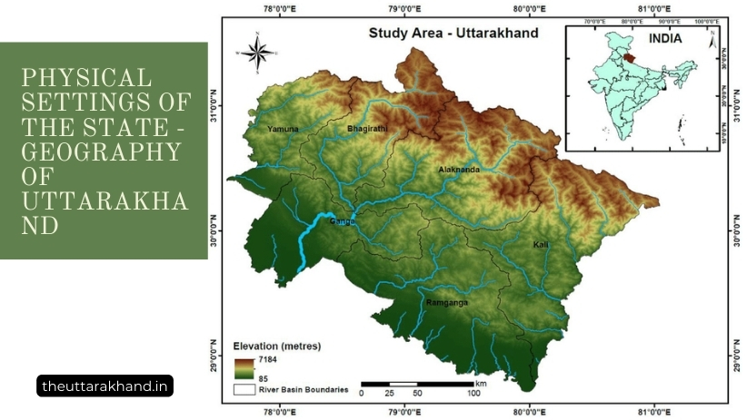
Physical Settings of the State – Geography of Uttarakhand
Uttarakhand’s landscapes encompass glaciers, rivers, mountains, valleys and plains. Learn about the state’s diverse geography and terrain.
Physical Settings of the State - Geography of Uttarakhand
Physical Settings of the State – Geography of Uttarakhand
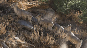
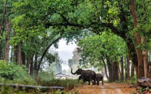
Physical Settings of the State – Geography of Uttarakhand : Uttarakhand is located in the northern part of India, nestled in the foothills of the Himalayan mountain ranges. The state has a diverse geography, with snow-capped mountain peaks, glaciers, rivers, dense forests and a rich biodiversity. This article provides a comprehensive overview of the physical geography of Uttarakhand.
Location and Extent
- Uttarakhand is situated between 28°43′ to 31°27′ N latitudes and 77°34′ to 81°02′ E longitudes
- The Tropic of Cancer passes through the middle of Uttarakhand
- It covers an area of 53,566 sq km, which is 1.63% of the total geographical area of India
- Uttarakhand is bounded by Tibet on the north, Nepal on the east, Himachal Pradesh on the northwest and Uttar Pradesh on the south
- The maximum length from east to west is about 400 km while the maximum width from north to south is about 200 km
Physiographic Divisions
Uttarakhand can be divided into following physiographic zones:
1. Himalayan Zone
- Consists of the Greater Himalayas and the Lesser Himalayas
- Altitude ranges between 6000 to 8000 metres above sea level
- Home to famous peaks like Nanda Devi (7816 m), Kamet (7,756 m), Trisul (7,120 m), and Bandarpunch (6,316 m)
- Important passes like Niti Pass, Lipulekh Pass, Untadhura Pass located here
- Valley of Flowers National Park and Nanda Devi Biosphere Reserve situated here
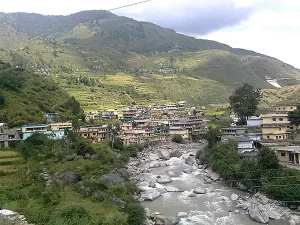
2. Middle Himalayan Zone
- Consists of valleys, ridges and ranges
- Altitude between 1000 to 4500 metres above sea level
- Important hill ranges are Nag Tibba, Mussoorie, Chaukhamba, Panchachuli, and Kumaon hills
- Valleys include Bhagirathi, Alaknanda, Mandakini, Pindar
3. Shiwalik Range
- Forms the southernmost low hills of the Himalayas
- Altitude ranges between 900 to 1100 metres above sea level
- Consists of sandstone, conglomerate rocks, alluvial deposits
- Prone to soil erosion
4. Tarai Plains
- Fertile alluvial plains between Shiwalik hills and plains of Uttar Pradesh
- Altitude ranges between 300 to 900 metres above sea level
- Prone to floods and excessive rainfall
Major Physical Features
Mountains and Hill Ranges
Some of the important mountain peaks and hill ranges in Uttarakhand are:
- Nanda Devi (7816 m) – second highest peak in India after Kanchenjunga
- Kamet (7,756 m) – highest peak lying entirely in India
- Bandarpunch (6,316 m) – part of Bandarpunch massif, a group of peaks
- Panchchuli (6,904 m) – group of five snowy peaks, visible from Munsiyari
- Trisul (7,120 m) – group of three mountain summits, revered by Hindus
- Chaukhamba (7,138 m) – four summits, known as Chaukhamba I, II, III and IV
- Mussoorie Range (2,000 to 2,500 m) – located south of Dehradun valley
- Nag Tibba (3,022 m) – highest peak of lesser Himalayas in Uttarakhand
Glaciers
Some important glaciers of Uttarakhand are:
- Gangotri Glacier – largest glacier in India, source of Bhagirathi river
- Pindari Glacier – located in Kumaon Himalayas, terminus near Pindari valley
- Milam Glacier – major glacier in the Kumaon region
- Namik Glacier – situated at the base of Nanda Kot in Kumaon Himalayas
- Poting Glacier – meets the Jadh Ganga River in the Garhwal region
Rivers and Drainage
The main rivers flowing through Uttarakhand are:
- Ganga – known as Bhagirathi and Alaknanda in Uttarakhand
- Yamuna
- Ramganga
- Kosi – known as Sarju in Kumaon region
- Gori – also called as Kali river
- Dhauli Ganga
- Pindar – flows through Pithoragarh district
Lakes
Some important natural lakes in Uttarakhand are:
- Roopkund – a high altitude glacial lake full of skeletons
- Deoria Tal – a beautiful lake near Chopta in Rudraprayag district
- Dodital – freshwater lake near Hanuman Chatti temple in Uttarkashi district
- Kedartal – lake situated near the Kedarnath temple
- Bhimtal – largest lake in Nainital
- Nainital – pear shaped natural lake that gave its name to Nainital town
- Sattal – group of seven interconnected freshwater lakes
Waterfalls
Uttarakhand has several scenic waterfalls, some prominent ones being:
- Kempty Falls – popular waterfall near Mussoorie
- Bhatta Falls – waterfall near Mussoorie having several cascades
- Benog Wildlife Sanctuary – home to Vasant and Bhanwari waterfalls
- Patna Falls – waterfall near Khirsu village, plunging from height of 350 feet
- Mossy Falls – huge waterfall on Pabbar river near Tons valley
Conclusion to Physical Settings of the State – Geography of Uttarakhand
Physical Settings of the State – Geography of Uttarakhand: Uttarakhand’s magnificent physical landscape comprising of lofty snow peaks, glaciers, rivers, lakes, and forests makes it a region of stunning natural beauty. However, the fragile Himalayan ecosystem also makes it vulnerable to natural disasters like floods, landslides and earthquakes. Balancing development needs while conserving the state’s natural heritage is essential for Uttarakhand’s future.
Physical Settings of the State – Geography of Uttarakhand :
Q: What major mountain ranges are located in Uttarakhand?
A: Some of the major mountain ranges in Uttarakhand include the Great Himalayas, Lesser Himalayas, and the Shivalik Range.
Q: How many glaciers are estimated to be in Uttarakhand Districts?
A: Uttarakhand has around 1,026 glaciers and many are located along or originate from the Great Himalayan range.
Q: What are some of Uttarakhand’s major river systems?
A: Key river systems in Uttarakhand include the Ganges, Yamuna, Alaknanda, Bhagirathi, Mandakini, Pindar and more.
Q: What kinds of diverse landscapes can be found in Uttarakhand?
A: Uttarakhand encompasses snow-capped mountains, alpine meadows, coniferous forests, deciduous woodlands, terraced farmlands, valleys and plains.
Q: How does Uttarakhand’s geography impact its climate?
A: The state’s extreme changes in elevation and landscape create a variety of microclimates ranging from alpine to temperate to subtropical.