Uttarkashi’s Natural Resources and Environmental Challenges
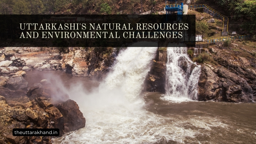
Uttarkashi's Natural Resources and Environmental Challenges
Uttarkashi’s Natural Resources and Environmental Challenges
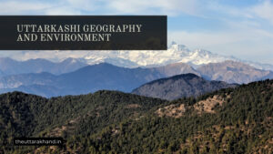
Uttarkashi’s Natural Resources and Environmental Challenges : Uttarkashi, located in the Indian state of Uttarakhand, is often referred to as the ‘Land of Gods’. Nestled in the lap of the Himalayas, the district is home to some of the most revered pilgrimage sites like Gangotri, Yamunotri, and Kedarnath. The district derives its name from the words ‘Uttar’ meaning ‘north’ and ‘Kashi’ referring to the holy city of Kashi (Varanasi). True to its name, Uttarkashi serves as the gateway to the northern Himalayan region and some of Hinduism’s holiest shrines.
The district is endowed with breathtaking natural beauty, fed by glacial rivers and dotted with snow-capped peaks. However, underneath this exterior lies a district facing several issues of environment and biodiversity conservation. This article comprehensively analyzes Uttarkashi’s natural resource base, specifically its rivers, hydroelectric potential, and environmental challenges.
Uttarkashi’s Natural Resources and Environmental Challenges : Natural Resources
Rivers
Uttarkashi serves as the origin point of two of India’s most iconic rivers – the Ganges and the Yamuna. Several important tributaries like Asi Ganga, Bhagirathi, Jad Ganga, and Tons also flow through the district.
Bhagirathi
The headwaters of the Ganges, the Bhagirathi originates from the Gangotri glacier, one of the largest in the Himalayas. The river is worshipped as the mother goddess and its water is considered pure and sin-cleansing by devout Hindus. Several temples and pilgrimage sites like Gangotri, Harsil, and Bhaironghati dot its banks.
The Bhagirathi basin has a total catchment area of around 5,180 sq km in Uttarkashi, out of which glaciers occupy around 1,737 sq km. The major tributaries of Bhagirathi in the district are Jad Ganga, Jalandhari Ganga, Kedar Ganga, Asi Ganga, and Bhatwari Ganga.
Yamuna
The Yamuna, the longest tributary of the Ganges, originates from the Yamunotri glacier near Banderpoonch peak. The actual source though lies 14 km further up at Champasar glacier. The river holds special religious significance as the daughter of Surya, the Sun God. The Yamunotri temple marks the origin point of the Yamuna and receives lakhs of devotees annually.
The Yamuna basin covers around 4,293 sq km in Uttarkashi district, out of which the glacial area is 1,395 sq km. The major tributaries of the Yamuna here are Hanuman Ganga, Gidya Ganga, and Khirao Ganga.
Tons
The Tons river, largest tributary of the Yamuna, originates from the Bandarpunch massif in Uttarkashi. The Tons valley runs parallel to the Yamuna valley, separated by the Bandarpunch range. The river meets Yamuna at Kalsi in Dehradun district.
The Tons and its tributaries like Supin, Rupin, and Guni drain a total catchment area of around 11,928 sq km in Uttarkashi district. Out of this, the glacial zone constitutes about 1,763 sq km.
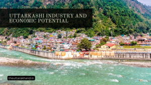
Potential for Hydroelectric Power Generation
The rivers of Uttarkashi hold immense potential for generating clean, renewable hydroelectric power. The district has been described as the future powerhouse of India. With abundant water resources, high relief, and suitable topology, Uttarkashi can produce electricity much beyond its current levels.
As per estimates, Uttarkashi district has a gross hydropower potential of nearly 15,000 MW across its various river basins. However, only around 10% of this has been harnessed so far. The below table summarizes the hydroelectric projects in Uttarkashi and their current status:
| River | No. of Projects | Installed Capacity | Under Construction |
|---|---|---|---|
| Bhagirathi | 15 | 1,805 MW | 1,170 MW |
| Yamuna | 1 | 530 MW | – |
| Asi Ganga | 3 | 36 MW | 114 MW |
| Jad Ganga | 1 | 4.5 MW | – |
Some of the upcoming major hydroelectric projects in Uttarkashi district are:
- Maneri Bhali Stage-II (304 MW): Under-construction on Bhagirathi river near Maneri village. To be owned by NTPC Limited.
- Loharinag Pala (600 MW): Run-of-river project on river Bhagirathi near Loharinag village. Awarded to NHPC Limited.
- Bhaironghati (381 MW): Proposed project on river Bhagirathi. To be developed by Kundan Group consortium. Environmental clearances obtained.
Several small, mini and micro hydroelectric projects are also coming up on the smaller rivers and tributaries. These decentralized power units can electrify remote mountain villages.
However, only about 35% of Uttarkashi households have access to electricity so far. Tapping the full hydroelectric potential while ensuring local energy access remains a key challenge.
Issues of Environment and Biodiversity
While critical for Uttarkashi’s development, hydropower expansion and uncontrolled tourism have also created several environmental issues.
Deforestation
Construction activities related to dams, tunnels, roads and power transmission infrastructure has led to loss of forest cover. Trees are cleared for project sites, construction material, firewood and other hydroelectric uses.
As per a study, each megawatt of installed hydropower capacity in Uttarakhand leads to removal of 114-269 trees on average. With several projects underway, the cumulative effect of deforestation is huge.
Impacts on Rivers
The natural flow of glacier-fed Himalayan rivers has been interrupted due to dams and diversion tunnels. Reduced river flows, especially during crucial low-flow seasons, affects the aquatic biodiversity downstream. Changes in water temperature and silt content also impacts certain fish species.
Several hydroelectric projects are designed to operate as peaking power plants, where water flow fluctuates drastically according to peak electricity demand periods. Such sudden water surges and drops impacts the river habitat.
Impacts on Wildlife
The rich forests and alpine meadows of Uttarkashi are home to endangered wildlife like snow leopards, Himalayan tahr, musk deer and monal pheasant. Land use changes due to hydropower projects disturb their natural habitat.
Quarrying, mining explosions, road construction and heavy machinery operation also generates noise and air pollution which affects wildlife. The threat of poaching has increased due to improved accessibility and greater human presence.
GLOF Risks
Several hydropower projects are located downstream of glacial lakes like Chorabari and Garhwal Tal. These lakes are at risk of glacial lake outburst floods (GLOF), which can release millions of cubic meters of water suddenly.
The downstream projects face high risks of extensive damage and production losses from potential GLOF events, which are likely to increase due to climate change impacts.
Conclusion to Uttarkashi’s Natural Resources and Environmental Challenges
Uttarkashi’s Natural Resources and Environmental Challenges : Uttarkashi is one of Uttarakhand‘s most vital districts owing to its rivers that feed North India’s plains. However, amidst the district’s strategic importance and power potential lies the need to balance environmental sustainability.
Deforestation, river flow changes, biodiversity loss and GLOF risks are key issues that require urgent redressal. Strict environmental regulation, use of renewable construction material, maintaining e-flows and local community participation can help mitigate the impacts.
As Uttarkashi gears up to meet India’s rising power demands, the principles of sustainable development must be followed to respect the fragile Himalayan ecosystem. The interests of local communities, forests and wildlife must also be safeguarded.
With prudent planning and cooperation between stakeholders, Uttarkashi can stake its claim as the renewable energy hub of North India without compromising ecological stability. The path ahead lies in harnessing its hydroelectric might sustainably while retaining its essence as Devbhoomi, the land of gods.