Regional Geography of Uttarakhand
Regional Geography of Uttarakhand
Introduction to Regional Geography of Uttarakhand
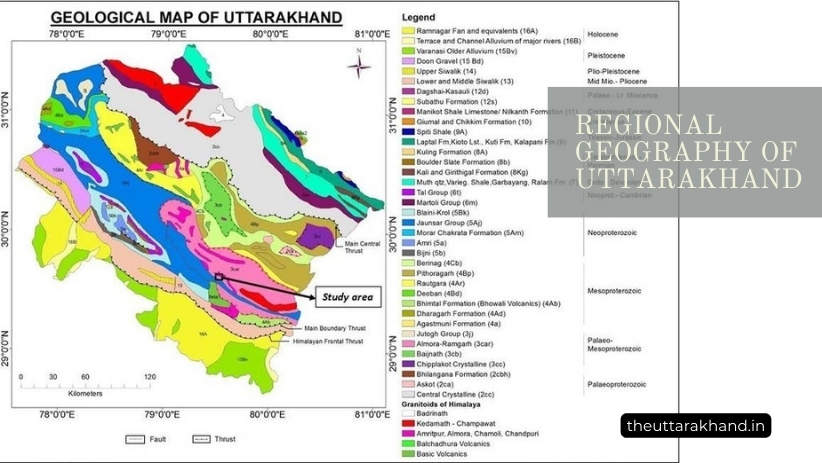
Regional Geography of Uttarakhand, Uttarakhand is a Himalayan state located in northern India. It was carved out of Uttar Pradesh in 2000 to address the development gaps and unique geographical character of the region. Spanning over 53,483 sq km, Uttarakhand comprises of two distinct regions – the hilly terrain and the plains. The state can be divided into several geographical regions based on physiography, climate, vegetation, wildlife, etc. This article provides a comprehensive overview of the regional geography of Uttarakhand.
Physiographic Regions
Based on physiography, Uttarakhand can be divided into the following regions:
1. The Great Himalayan Range
- Comprises very high, rugged, snow-clad peaks like Nanda Devi (7,817 m), Kamet (7,756 m), etc.
- Contains several glaciers that are source of major Himalayan rivers
- Average height ranges from 6,000 to 7,000 m, with some peaks over 8,000 m
- Very cold and inhospitable terrain, with limited vegetation and wildlife
2. The Lesser Himalayan Range
- Parallel to the Great Himalayas, average height 3,000 to 4,500 m
- Composed of soft sedimentary rocks, more eroded and rugged terrain
- Rich in forest vegetation with species like pine, deodar, oak, rhododendron
- Home to wildlife like leopards, black bears, musk deer, monal, etc.
3. The Shiwalik Range
- Southernmost and outermost range of Himalayas bordering the plains
- Composed of unconsolidated deposits like sand, silt, clay and boulders
- Prone to erosion, landslides common during monsoon season
- Scrub forests with species like sal, khair, shisham, jamun, etc.
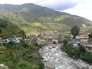
4. Dun Valleys
- Long and wide structural valleys between Lesser Himalayas and Shiwaliks
- Formed by intermontane rivers and streams over geological time
- Fertile alluvial soil, moderate climate suited for agriculture and habitation
- Also called ‘duns’, important valleys are Dehra Dun, Kotli Dun, Patli Dun
5. Tarai Plains
- Fertile alluvial plains between Shiwalik hills and Indo-Gangetic plains
- Formed by depositional work of Himalayan rivers entering the plains
- Hot and humid climate in summers, cold winters with fog
- Sal and bamboo forests along with agricultural land
Agro-Climatic Zones
Based on climate, vegetation and agricultural suitability, Uttarakhand can be divided into following agro-climatic zones:
1. Alpine Zone
- Above tree line at height over 3,600 m in Higher Himalayas
- Very cold with temperatures below freezing most of year
- Limited vegetation of mosses, lichens and short shrubs
- Used for summer grazing of sheep and goats
2. North Western Himalayan Zone
- Elevation – 1,500 to 3,600 m
- Annual rainfall – 1,000 to 1,500 mm
- Cool temperate climate, snowfall and frost common in winters
- Coniferous forests of deodar, blue pine, oak, rhododendron, etc.
3. Western Himalayan Zone
- Height – 350 to 1,500 m
- Rainfall – 1,000 to 2,000 mm
- Mild summers and cold winters with some snow
- Broadleaf forests of oak, chesnut, walnut, willow, etc.
4. Bhabhar and Tarai Zone
- Tarai plains and adjacent Bhabhar tract
- Hot summers, cool winters, foggy conditions common
- Rainfall – 1,500 to 2,000 mm
- Sal and bamboo forests along with agriculture
5. Mid Hills Sub-Humid Zone
- Lesser Himalayan ranges and dun valleys
- Elevation – 700 to 1,700 m
- Rainfall – 1,400 to 2,000 mm
- Mild climate, conducive for horticulture crops
- Oak, rhododendron, pine vegetation
6. Low Hills Sub-Tropical Zone
- Shiwalik ranges and outer dun valleys
- Hot summers, cool and dry winters
- Rainfall – 1,000 to 1,400 mm
- Scrub forests along with agriculture
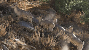
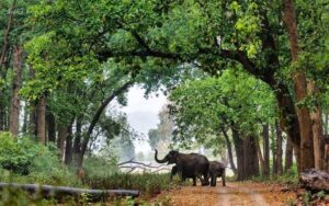
Wildlife Regions
Uttarakhand has a diversity of wildlife habitats ranging from high altitude Trans-Himalayas to Shiwalik foothills. Key wildlife regions are:
1. Alpine Zone
- Area above treeline in Higher Himalayas
- Snow leopard, Himalayan brown bear, blue sheep, musk deer
- Many high altitude birds like snow partridge, snow cock, chukor, etc.
2. North Western Himalayan Zone
- Temperate coniferous forests in Lesser Himalayas
- Black bear, leopard, serow, monal, koklass, cheer pheasant, etc.
- Many Western Himalayan bird species
3. Western Himalayan Zone
- Broadleaf forests in Lesser Himalayas
- Leopard, sloth bear, barking deer, goral, kalij pheasant, etc.
- Pheasants, drongos, babblers, laughing thrushes, etc.
4. Shiwalik Zone
- Scrub and deciduous forests in Shiwalik hills
- Elephants, tigers, sambar, hog deer, gray francolin, etc.
- Hornbills, woodpeckers, barbets, bee-eaters, etc.
5. Tarai Zone
- Lowland Sal forests and grasslands
- Elephants, tigers, swamp deer, hispid hare, Bengal florican etc.
- Peafowl, red jungle fowl, parakeets, munias, etc.
Cultural/Ethnographic Regions
The native inhabitants of Uttarakhand belong to either Kumaoni or Garhwali cultural groups. Based on this, following cultural regions can be identified:
1. Garhwal Region
- Comprises Garhwal division except Udham Singh Nagar
- Garhwali language and culture is predominant
- People practice polyandrous marriages in some remote villages
- Main festivals – Dussehra, Diwali, Holi and Shravani Mela
2. Kumaon Region
- Covers Almora and Nainital districts
- Kumaoni language and culture prevails in the region
- Matrilineal Khasa tribe inhabits remote hill villages
- Major festivals – Nanda Devi Raj Jat, Gheeya Sankranti, Bat Savitri
3. Jaunsar-Bawar Region
- Covers Jaunsar area of Dehradun district
- Tribal region inhabited by Jaunsari tribe having distinct culture
- Own language, follow polyandry, animistic beliefs and nature worship
- Losar and Fagli major festivals
4. Rohilkhand Plains
- Comprises Tarai area of Udham Singh Nagar district
- Influenced by neighboring Rohilkhand plains of Uttar Pradesh
- Awadhi dialect and plains culture is common
- Holi, Diwali and Chaumos major festivals
Conclusion to Regional Geography of Uttarakhand
Regional Geography of Uttarakhand, Despite its small geographic area, Uttarakhand exhibits tremendous diversity in its physical landscape ranging from snow-capped Greater Himalayan peaks to the subtropical Tarai plains. There is corresponding diversity seen in climate, natural vegetation, agriculture as well as human habitation across the different physiographic regions of the state. The unique geography contributes to the state’s rich biodiversity as well as cultural heritage. However, the fragile Himalayan ecosystem also makes it vulnerable to natural disasters like floods, landslides and earthquakes. Balancing development needs while conserving the Himalayan environment is a major challenge for Uttarakhand.
FAQs on Regional Geography of Uttarakhand:
What are the main physiographic regions of Uttarakhand?
The key physiographic regions are the Great Himalayas, Lesser Himalayas, Shiwaliks, Dun Valleys and Tarai Plains.
What are some major agro-climatic zones found in the state?
The main agro-climatic zones are Alpine Zone, North Western Himalayan Zone, Western Himalayan Zone and Bhabhar-Terai Zone.
What major wildlife habitats exist in Uttarakhand?
Key wildlife regions include the Alpine Zone, North Western Himalayas, Western Himalayas, Shiwaliks and Tarai zone.
What are the major cultural/ethnographic regions?
The Garhwal, Kumaon, Jaunsar-Bawar and Rohilkhand Plains are the main cultural/ethnographic regions.